UK facing sky-high temperatures next week after tropical cyclone Franklin burst
An ex-tropical cyclone is going to help send temperatures sky high next week, possibly touching 27C, just in time for the return to school as August ends.
After what many have considered a pretty miserable summer, temperatures are set for what may be one last spike next week. They will return to numbers more commonly associated with the middle of summer, not the first day of term.
But after miserable and wet parts of the summer, and temperatures rarely topping over 30C, most Brits will welcome the late burst of sunshine. And set to play a key role in the return of the warmth is a former tropical cyclone spinning away in the Atlantic.
Ex-tropical cyclone Franklin, along with the more threatening tropical storm Idalia, marked the beginning of the US hurricane season this week. Whilst it peaked at winds of around 130mph, Franklin drifted across the Atlantic, slowly losing power, and its designation as a tropical cyclone.
 Hurricane Idalia won't hit the UK but a former tropical cyclone sitting in the Atlantic will help weather take a turn for the better (CNN)
But Met Office spokesperson Stephen Dixon explained to the Mirror how this ailing cyclone will play a role in helping warm weather hit the UK. He said: “Franklin itself hit parts of America earlier this week but hasn’t been on land for a bit. It’s sat up in the Atlantic, a deep area of low pressure and what these systems do is help to move air masses to the UK.
 Gales, snow and rain to batter country today with 80mph wind gusts
“This low pressure system is helping draw warmer air over the UK, the warmer continental air which will bring temperatures up to the mid-20s in parts of England and Wales. Initially it’ll help develop the warmer conditions.”
After this, he explained how a bloc of high pressure would sit across the UK. There could still be a bit of drizzle in northern parts of Scotland, but settled conditions would settle quite widely across the UK.
Mr Dizon added: “Even as we move into meteorological autumn, the sun’s still got some strength so will still help the temperatures build day by day into the middle of next week.”
He said temperatures could get as high as 27C.
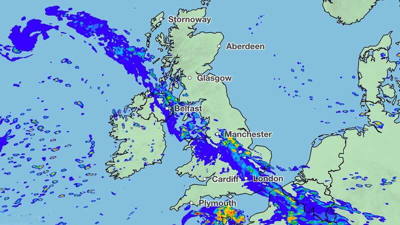
Whilst Brits have better temperatures to look ahead to, in the meantime its rainy and wet in places across the country. A band of rain stretching north west to south east, swept across the UK and helped lead to a number of flood alerts and warnings in England and Wales.
In England there are 33 flood alerts, where it is possible for flooding, and four flood warnings where it’s expected. These are centred along the Cumbrian coast, but also in Poole Harbour. They are in:
- Cumbrian coastline at North Morecambe Bay, along the coast from Roosebeck to Carnforth
- Cumbrian coastline at North Morecambe Bay, between Roosebeck, Ulverston, Flookburgh and A590
- Cumbrian coastline from Silloth to St Bees including Maryport, Flimby, Workington and Whitehaven
- Poole Harbour at West Quay and Lower Hamworthy Quay
In Wales there’s one flood alert along the coastline of the Lleyn Peninsula and Cardigan Bay.
Read more similar news:
Comments:
comments powered by Disqus