Met Office issues rare amber snow and ice warnings across almost entire UK
A rare amber snow warning has been issued for the UK as seven inches of the white stuff is expected to fall.
According to provisional recordings by the Met Office, the mercury fell to as low as minus 13C in Glen Ogle, central Scotland, while minus 11C was recorded at Tulloch Bridge in the Scottish Highlands. Forecasters had predicted some snow covered parts of Scotland could reach minus 15C overnight, which would have been the coldest January night for 14 years. The last time temperatures dropped that low was in January 2010, when minus 22.3C was recorded. Tuesday night did mark the coldest night this winter so far, beating the minus 12.5C daily minimum temperature recorded at Altnaharra in the Scottish Highlands on December 3.
The severe drop has lead the UK's national forecaster to issue an Amber alert for a number of areas in Scotland. The rare warning is more severe than the yellow advisories seen in recent days, and means there is an "increased likelihood of impacts from severe weather". This includes the possibility of "travel delays, road and rail closures and power cuts". It also presents a higher risk to "life and property", according to the agency. The alerts are currently in place in the Northern Isles and northwest Scotland, which will also have a knock-on effect on travel across the region.
 Snow falls on Speke, Liverpool yesterday as temperatures plummeted again (PA)
Over the past few hours, the agency has issued several more warnings, including yellow weather warnings for snow and ice in Yorkshire and Humber, the North East, East Midlands, South West England, East of England, Wales, West Midlands and North West England. There are also several yellow warnings for wind in Northern Ireland, South West England, Strathcylde, Grampian, and Dumfries, Galloway, Lothian & Borders.
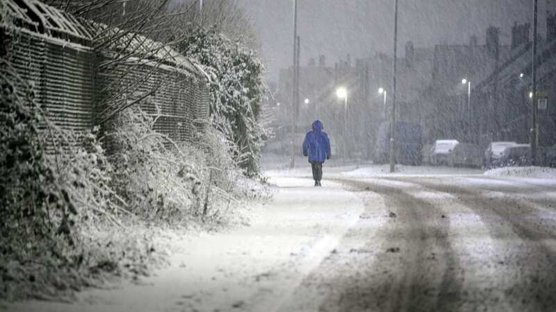
Freezing temperatures and snow will continue for much of Britain this week because of cold Arctic air before "potentially disruptive" stormy weather lands over the weekend. A "cold plunge of Arctic air" has moved south across the whole country over the past few days, making it 5C to 6C lower than usual for this time of year, the Met Office said.
 Gales, snow and rain to batter country today with 80mph wind gusts
 Icicles hanging from a bridge at the Killhope slate mine in County Durham today (PA)
A Met Office spokeswoman said the low temperatures are also due to how long the cold snap has lasted. She said: "It's due to the prolonged nature of this cold spell, it will have been lasting for quite a few days. A build up of snow, as well, just allows for the temperatures to get colder and colder and we don't often see a cold spell last three to five days. The air is coming directly from the Arctic, so it is exceptionally cold air. It's staying cold until Friday, and then looking further ahead into the weekend we've got some deep areas of low pressure pushing in, so a big change in weather type, and we could see some stormy conditions by the end of the week. The cold isn't lasting right to end of the week, but we have a very different type of potentially-disruptive weather arriving."
The weather is forecast to turn stormy on Sunday, she added. Yellow weather warnings for snow and ice are in place across Scotland, much of northern England and parts of North Wales until Thursday, then more mild temperatures are forecast along with wind and rain.
 The Amber alert is in place over parts of Scotland (Met Office)
More than 40cm of snow could be seen on high ground in north-west Scotland by the end of Friday as it continues to build up over the coming days, the Met Office added. Meanwhile, lower ground in north-west Scotland could see between five and 10cm of snow by the end of the working week.
The Met Office said on Tuesday: "There is a system skirting the south of the UK tonight and on Wednesday. This could bring a few snow flurries to the far south with a small chance of pushing slightly further north to bring more snow to southern counties."
Read more similar news:
Comments:
comments powered by Disqus