Exact date snow clouds set to freeze Brits between Christmas and New Year
There is a “high degree of confidence” that the UK will see snow over the Christmas period, and although it doesn't mean the country would be covered some places can expect flurries.
Things will soon turn colder, and new weather charts show that we could start seeing the white stuff fall in the early hours of Wednesday December 27. The clouds will cover north Wales and Cumbria, before they move towards Manchester later that evening.
Scotland won't escape either, with the Pennines and Scottish Highlands likely to see snow within days. Before that, the overall pattern will remain “generally mild” but it will be a cold Christmas Day, especially in the north, as things turn chilly from Sunday. This week is expected to get a little colder as it progresses and some snow could fall on lower ground in the northern areas, data from WXCharts shows.
 Purple patches suggest there will be some snow possible next week (WXCharts)
“We can say with a high degree of confidence it will be a white Christmas this year,” Met Office spokesperson Grahame Madge told The Independent. “However - that does not mean we will see blankets of snow. It is more likely we will see snow in higher parts of the UK like the North Pennines or in the Scottish Highlands."
The forecast for Christmas Day looks clear, but for some early morning rain in England's north west and the coast of north Wales. Showers are expected across Cornwall from midday on Monday. But it will be cold with weather models suggesting a low-pressure system swirling across Scandinavia, pulling bitter winds to Britain in from the Arctic Circle meaning -4 conditions are expected overnight for some.
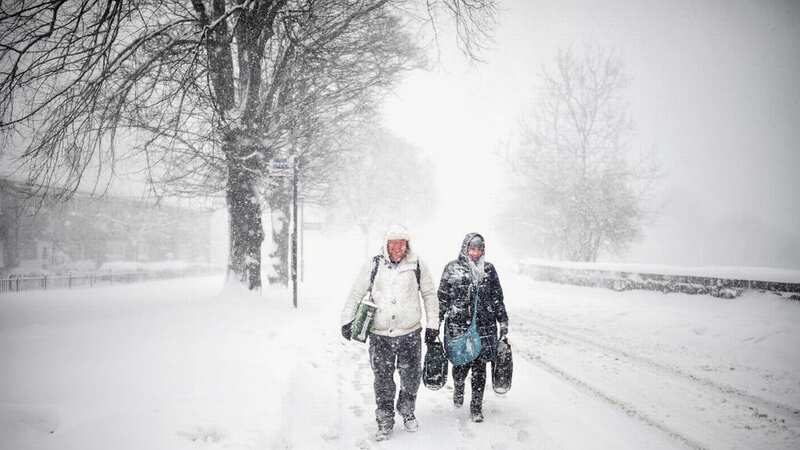
 Gales, snow and rain to batter country today with 80mph wind gusts
It expected to move to the north of the UK over the Norwegian Sea through tonight and into tomorrow. This area will bring very strong winds and heavy showers to a large portion of the UK, with a yellow warning covering Scotland, Northern Ireland, Northern England and the north of Wales.
“From late Wednesday into Thursday, strong winds are likely to develop across a large area of the UK," Met Office deputy chief meteorologist Chris Almond said. "We’ve issued a large yellow warning area where there’s a potential for some impacts, but gusts of 50-60mph are possible for large parts of central and northern areas of the UK. Exposed coasts and high ground could see gusts of 70-80mph at times."
As technically only a snowflake on Christmas Day would make it a white Christmas, the Met Office has stated that this would not be unusual. And Deputy Chief Meteorologist, Helen Caughey said that there could be “wintry showers” in the north. She stated: “Wintry showers continue to feed in across the north and here colder conditions also mean rural areas will likely see a frost on Christmas morning. As we begin Christmas day, wintry showers initially feeding in across the north in the colder air mass would technically make it a white Christmas, as we only need to see a single flake falling."
The Met Office has said it is “unlikely” that the UK would see any “widespread or settling snow” on Christmas Day. Ms Caughey added: “Although technically it might be a white Christmas, don’t get your hopes up for a picture-perfect white landscape.” The definition of a white Christmas is when one snowflake is observed falling in the 24 hours of December 25 somewhere in the UK.
Read more similar news:
Comments:
comments powered by Disqus


