Met Office warns Britain to plunge into sub-zero freeze as cold front arrives
Freezing sub-zero temperatures are set to strike this week as a new cold front arrives, according to the Met Office.
The national forecaster says a change in the weather is expected due to chilly winds coming from the north, pushing away the slow-moving warm front that has kept conditions generally milder over recent days.
Current forecasts show temperatures diving below freezing early on Tuesday in northern parts of the UK, with this expected to repeat overnight on Wednesday.
Newcastle, Glasgow and Inverness are among the cities likely to see sub-zero nights come the middle of the week, while areas further south will drop to the low single figures.
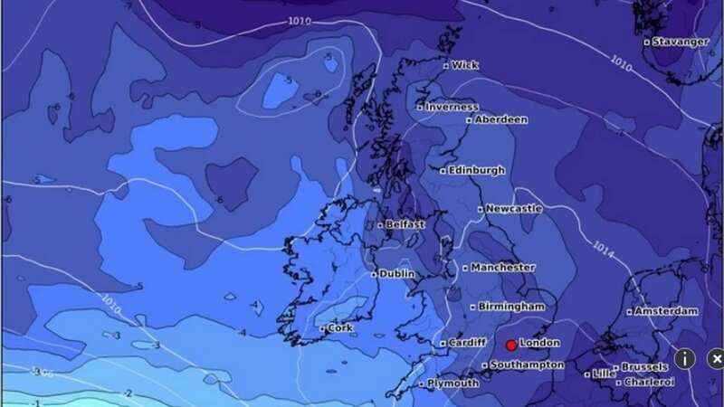
 Weather for Monday February 12 (WX CHARTS)
Other forecasters are tipping the cold weather to stick around into the weekend and beyond, and weather charts from WXCharts show harsh lows of a minimum -11C the following Monday. The clash between the cold and warmer weather fronts is also likely to bring an increased risk of snow over the next few days, according to the Met Office, with the chance of "disruptive" falls across some areas of the UK on Thursday and Friday.
 Gales, snow and rain to batter country today with 80mph wind gusts
Tom Morgan, Met Office Operational Meteorologist, told the Mirror last night: "As we go through into Tuesday and Wednesday, we start to see a cold front moving down from the north. At this stage, it's still fairly mild in the south. Towards Thursday and Friday, there will be a 'battleground' scenario set up across the UK.
"We'll see milder conditions trying to return northwards, and colder air still in north and central parts of the UK. Along that boundary we'll see probably some significant and disruptive snow."
Current projections show that the north of England, Scotland and Northern Ireland would be likely to be the worst affected by the snow. He added: "At this stage, there's still some uncertainty as to where that boundary will be. It looks like northern England, the Pennine regions are most prone to seeing the heaviest snow - possibly southern Scotland and Northern Ireland as well." Looking further ahead in the long-range forecasts, the Met Office also predicts unsettled weather during the first half of February, with the possibility of "wintery" showers developing across the UK by the middle of the month.
UK weather
Monday:
Early bright or sunny spells for some, especially in southern parts of the region. Otherwise, another cloudy and mild day with patchy drizzle. Staying windy with gales possible in places. Maximum temperature 11 °C.
Outlook for Tuesday to Thursday:
Cloudy and windy on Tuesday with heavy rain arriving later. Colder and brighter on Wednesday, then rain and snow on Thursday, possibly heavy and disruptive in places. Windy at times.
Read more similar news:
Comments:
comments powered by Disqus


