Flood warnings issued along River Thames - and central London affected
The Environment Agency has issued a flood alert for the River Thames, warning that water levels are expected to rise as a result of spring tides.
There is a risk of low-level flooding of riverside roads and open spaces due to the next high tide at London Bridge, which is expected at 3.15am on Sunday. River flows are expected to remain high for the next few days and the Environment Agency said it will continue to monitor the situation, and issue a further update on Sunday morning.
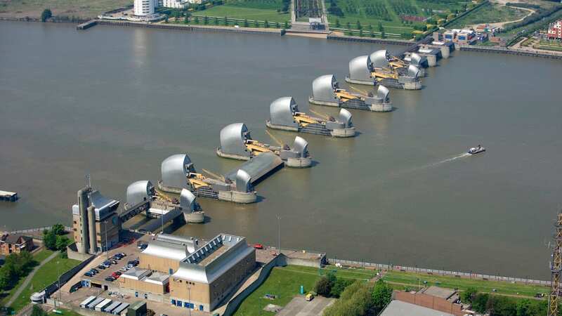
The alert covers the area from the Thames Barrier to Putney Bridge in London. It includes the following counties: City of London, Greater London, Greenwich, Hammersmith and Fulham, Kensington and Chelsea, Lambeth, Lewisham, Newham, Southwark, Tower Hamlets, Wandsworth, Westminster.
The flood alert said: "River levels are expected to be high as a result of spring tides. The next high tide at London Bridge at 03:15 on 14/01/2024, may result in brief low-level flooding of riverside roads and open spaces. Astronomical tide levels are rising. The river flow at Teddington Weir is high for this time of year at 270 cubic metres per second and is falling. We anticipate the flows to remain high for the next few days. We are closely monitoring the situation."
Meanwhile, Brits have been warned to brace for sub-zero temperatures as an Arctic blast makes its way towards the UK. A Cold-Health Alert has been issued across nine regions in England - and vulnerable people, particularly those aged over 65, have been urged to take extra care as significant impacts are possible due to the severity of the weather.
 Plane passengers stuck on flight for 13 hours - only to end up where they began
 The areas covered by the flood alert
Dr Agostinho Sousa, head of extreme events and health protection at UKHSA, previously said: "The temperatures we will see leading into the weekend can rapidly have a serious impact on the health of those over the age of 65 and those with pre-existing health conditions as it increases the risk of heart attacks, strokes and chest infections. It is therefore vital to check in on friends, family and neighbours to ensure they are well prepared for the cold weather next week."
Yellow weather warnings of snow and ice are then in place for much of the north of Scotland from 12am on Sunday until 11.59pm on Monday. The warning spans Stonehaven and Aberdeen in the east to Skye and the Western Isles.
All parts of Scotland north of these areas are likely to be affected, with temperatures as low as minus 4C expected. The Met Office warned travel disruption is possible with some roads and railways affected, and longer journey times by road, bus and train are likely.
It also warned of icy patches on roads, pavements and cycle paths, and said there is a small chance that power cuts will occur. Mobile phone services may also be affected, and snow-covered roads may lead to stranded vehicles. The south will remain cloudy on Sunday, with forecasters expecting some outbreaks of rain. Elsewhere will be colder with sunny spells and wintry showers, mostly along the coasts and in Scotland.
The Met Office has also issued a yellow weather warning of snow and ice for Northern Ireland early next week. The warning comes into force on Monday at 3am and runs until 11.59pm on Monday. Northern areas could see more significant snowfall on Tuesday, while there is a small chance of snow in the south on Wednesday.
Read more similar news:
Comments:
comments powered by Disqus