Forecasters predict 15-day 'snow bomb' for Britain in New Year
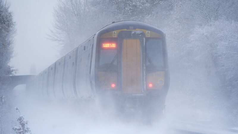
A 15 day 'snow bomb' looks set to hit Brits with freezing weather in the first few weeks of 2024.
Meteorologists have forecast a Sudden Stratospheric Warning - a sharp rise in temperatures causing a blocking of high pressure - which could trigger snowfall in parts of the UK. The first half of January could see a cold snap heralding a sprinkle of the white stuff - particularly for those living in rural parts of Scotland and the North.
But 2023 looks set to fizzle out on a miserable spell of traditionally British weather, with yellow warnings issued for Storm Gerrit bringing rain and wind across huge swathes of the country on Wednesday and Thursday. Forecaster James Madden told GB News: "There are now strong indications for a major SSW to occur during the early part of January and, if it does, many parts of the UK can expect to end up in the freezer with snow events and severe cold weather."
Speaking to The Mirror over the weekend, Met Office forecaster Dan Stroud said: "Into the New Year, high pressure will bring an increased chance of prolonged spells of cold weather. There's some potential there for wintry hazards, more so than the past few years for January."
The fourth named storm this month follows strong gales from Storm Pia on Thursday last week. The weather agency has issued eight separate yellow alerts coming in from the early hours of Wednesday morning, hailing gusts of up to 60mph and lashings of rain which could cause chaos for Brits travelling over the Christmas week.
 Gales, snow and rain to batter country today with 80mph wind gusts
 A sudden stratospheric warning could plunge Britain into a two week cold snap in the New Year (PA)
Chief Meteorologist Frank Saunders said: "Storm Gerrit will run towards [the] western UK on Wednesday and bring with it potential impacts for much of the country. Winds across southern coastal areas of England will be strong, possibly peaking around 70 mph on exposed coastlines, but more widely around 50-60 mph.
"Rain is an additional hazard from Storm Gerrit, with active weather fronts leading to a wet day for many. Snow is also likely to cause problems for some northern areas: only briefly for a few upland routes across the Pennines and southern Scotland overnight and early on Wednesday, but more widely to the north of the Central Lowlands later in the day."
 Several warnings have been issued for swathes of the UK on Wednesday (Met Office)
Weather warnings continue into the early hours of Friday morning for parts of the UK such as the north and west coasts of Wales, the North West and western Scotland. Most parts of the UK including the Midlands and south coast will see blustery, wintry weather over the coming couple of days.
There are also yellow alerts in place for the Scottish mountains and the Shetland Islands for snow on Wednesday and Thursday. The Met Office warning said: "Gusts are likely to reach 50-60 mph fairly widely, with a risk of 65-70 mph across some exposed headlands"
A spokesperson added that the weather was likely to remain showery for the first week of January, "perhaps with some drier and brighter interludes at times". But its long-range forecast adds: 'From the middle of January onward, conditions will probably turn drier and more settled as high pressure starts to have a greater influence. This also means an increased risk of more prolonged and widespread cold conditions.'
Read more similar news:
Comments:
comments powered by Disqus